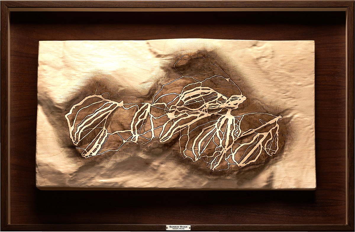
Mahoosuc Range
Newry, Maine
Relief of the Southern Mahoosuc Range, a connected system of peaks in western Maine, carved in basswood and framed in walnut. The carving traces linked summits, ridge systems, and valleys across the range. Laser-etched trails follow the route network across the connected terrain.
Shaping of Place
The Mahoosuc Range is Appalachian terrain shaped through a major continental collisions more than 300 million years ago. Erosion-resistant bands of schist and quartzite run through the bedrock, giving the range its ridges, ledges, and abrupt transitions. Glaciation later deepened valleys and sharpened the modern profile, leaving a range defined by linked summits, exposed ridgelines, and broken passage.
What distinguishes the Mahoosuc is its connectedness. Summits, ridges, valleys, and exposures gather into a continuous range of linked high points. The terrain unfolds in sequence, with each valley interruption leading toward another rise, another ridge, and another section of exposed ground.
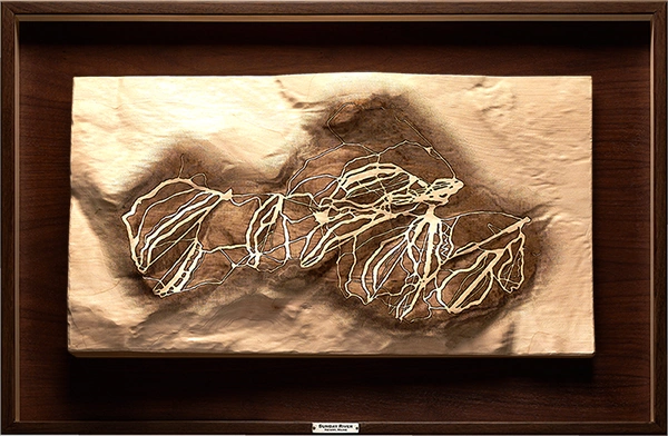
Southern Mahoosuc Range, full composition.
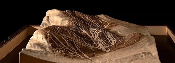
Angled view showing dimensional relief.
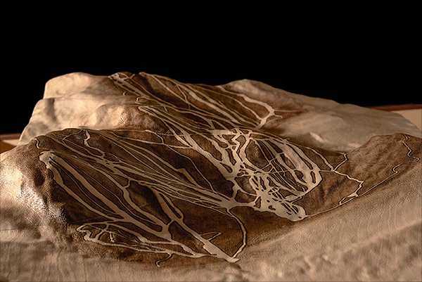
Laser-etched trails and terrain transitions.
The Mahoosuc Range was approached as connected terrain, a sequence of ridges, valleys, and exposures extending across distance. Its character comes through movement along the range: summits link, valleys interrupt, and trails cross from one exposure to the next.
The composition was arranged to emphasize lateral continuity. Ridges move laterally across the relief, while valleys divide the range into distinct zones within the larger structure.
Trail etching was kept clear but restrained. The range's larger presence remains in the carved ridges and valleys. Floating within the frame, the relief remains visually unbound, connected to a larger landscape while retaining its own quiet authority.
Artist's Note