Cape Ann
Massachusetts
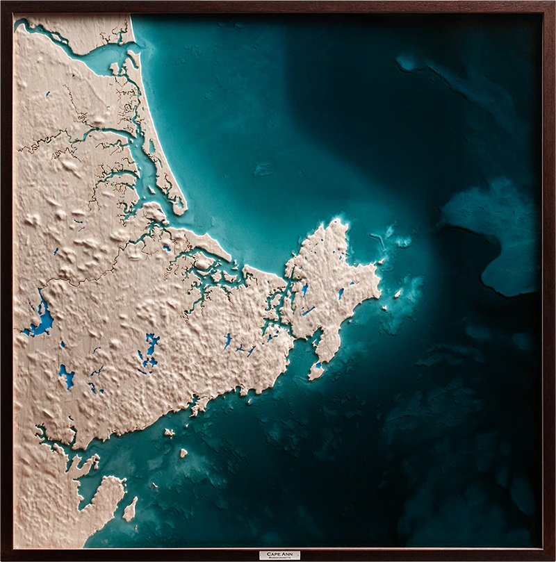
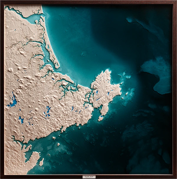
Relief of Cape Ann, where granite shoreline, tidal estuaries, and working water meet the Atlantic, carved in maple and framed in mahogany. The carved landform carries the cape's shoreline, tributaries, and inland watershed. Translucent resin defines the tidal edge and offshore shelf along the carved shoreline.
Shaping of Place
Cape Ann is built on hard, erosion-resistant granite dating back hundreds of millions of years, later scoured by glaciation and continually shaped by Atlantic water. Its rocky coastline holds in points, ledges, coves, and harbors where durable bedrock has resisted erosion. The cape's edge carries the visible record of older rock, moving ice, and ongoing coastal force.
Across Cape Ann, freshwater and seawater meet through tributaries, marshes, tidal rivers, and harbor basins. Tides move sediment through channels and coves, storms reshape exposed edges, and the offshore shelf affects how Atlantic water approaches the coast. Cape Ann remains a coastal system shaped by resistance, exchange, and forces held in constant tension.
Cape Ann relief, full composition.
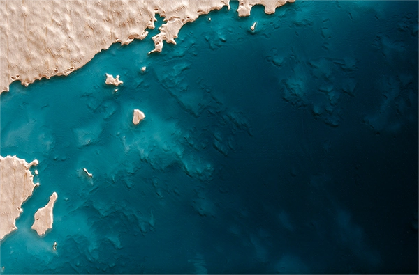
Offshore shelf and seafloor detail.
The couple’s children commissioned this piece for their parents’ 50th wedding anniversary, centering the work on continuity. Their marriage had been shaped over decades along the same granite coast, with rivers, marshes, harbors, and offshore water all part of the place they call home.
Tributaries, tidal marshes, and bathymetry were brought into the relief, expanding the coast from shoreline to coastal system. Tributary lines were laser-etched farther inland, where freshwater movement, tidal exchange, granite shore, and offshore depth shift gradually into one another.
The resin was mixed toward the color of Atlantic summer water, with a sea-glass tone suited to the coast. Land, sea, and family history occupy the same field of view.
Artist's Note